Ski Pitch
How steep is that run, really?
A black diamond at one resort can be a blue at the next. Ski Pitch measures every run at 649 resorts across the US and Canada from detailed elevation data, and shows how steep it actually gets, in degrees, before you're standing at the top.
How it works
From trail map to true steepness
Pick a resort
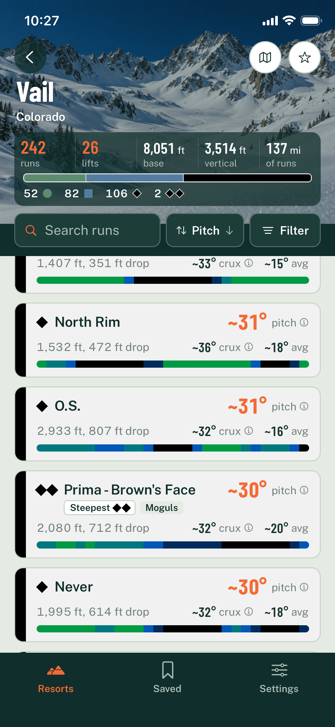
Browse 649 resorts by region or state, or search by name. Each one opens with its runs, lifts, base elevation, vertical drop and the mix of greens, blues and blacks.
See how steep each run gets
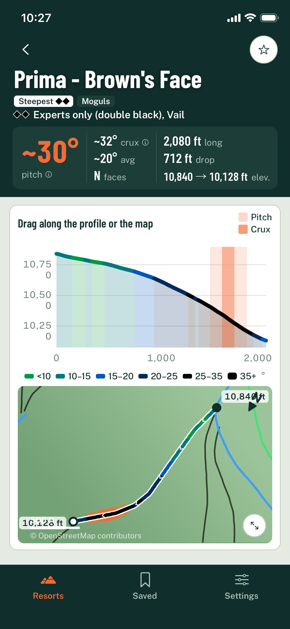
Every run shows its pitch, the steepest 330 ft (100 m), and its crux, the steepest 100 ft (30 m). Sort and filter by steepness, rating or terrain, and spot the steepest and easiest run of each color.
Scout the line
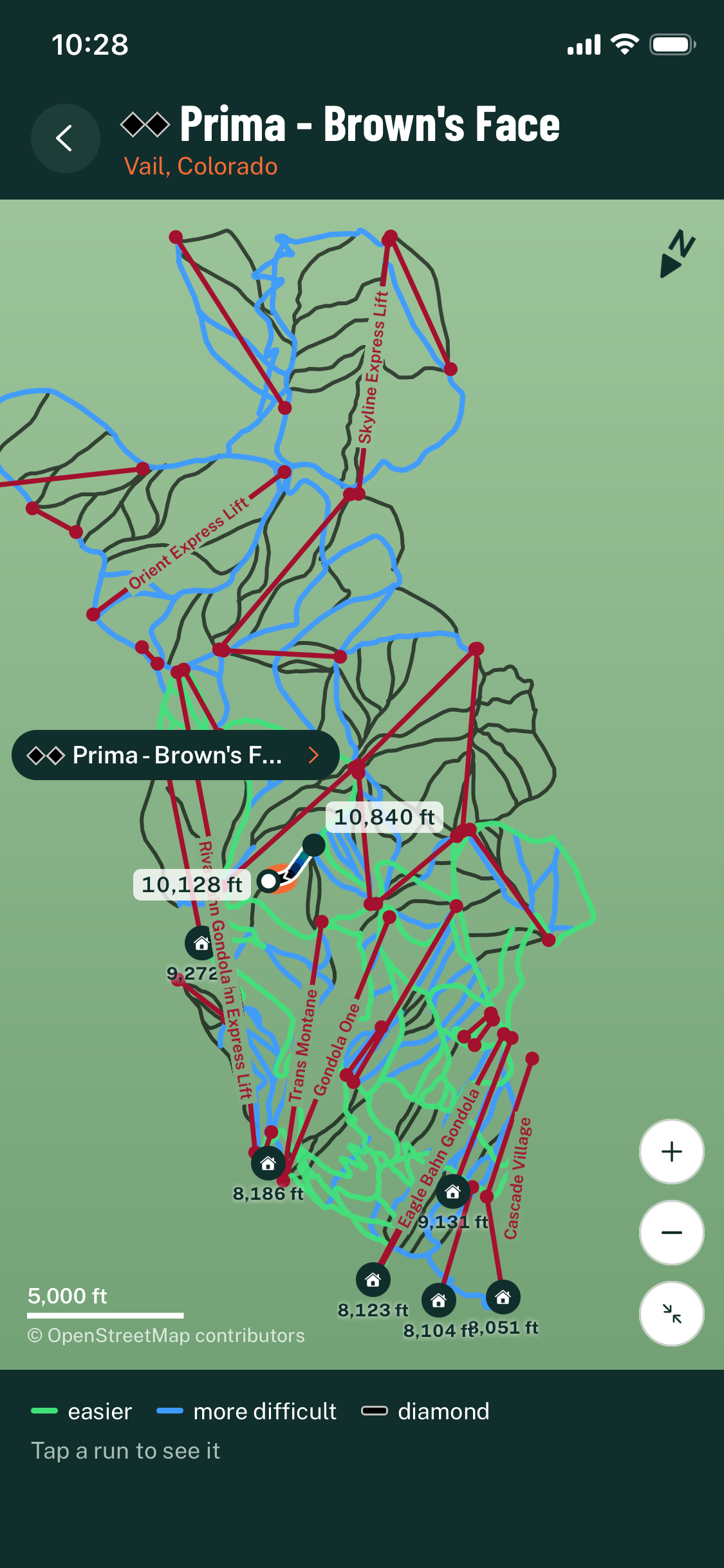
Drag along the elevation profile or the trail map to read the slope at any point. Open the whole resort map to see where the run sits among the lifts and other runs.
What you get
Built from real terrain, not trail-map symbols
Privacy
No sign-in, no ads, no tracking
All resort and run data is built into the app, so it works on the mountain without a signal. Saved runs and settings stay on your phone. Nothing leaves it unless you choose to send us a message or report a problem. See our Privacy Policy.
Waitlist
Get notified when Ski Pitch launches
Enter your email and we'll tell you when the app is ready to download. One message only, no spam.
We respect your privacy. See our Privacy Policy
Run and lift data © OpenStreetMap contributors, available under the Open Database License, via OpenSkiMap. Elevation data from the USGS 3D Elevation Program, Natural Resources Canada (HRDEM and MRDEM, Open Government Licence – Canada) and LidarBC (Open Government Licence – British Columbia).